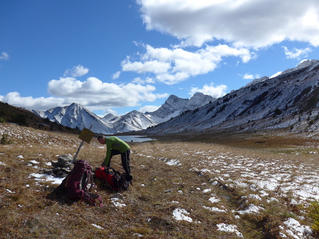
Backpacking over Jasper Park’s Glacier Pass on the park boundary with Willmore Wilderness. Lizzie Wolkovich photo.
Following Mount Robson’s Berg Lake trail and Jasper National Park’s Twintree Creek bridge washouts in 2021, backpackers have been looking for North Boundary Trail alternatives. The washouts left backpackers with a truncated North Boundary Trail across the northern reaches of Jasper National Park and suddenly, there was a blossoming interest in destinations further north—Hardscrabble, Glacier and McLaren Passes.
We’ve long considered these branch trails far more interesting than the North Boundary Trail itself. With no prospect of the Berg Lake trail reopening or the Twintree Creek bridge being replaced in the near future, we are pleased to see more adventurous souls heading beyond this rather mundane route.
Discovering the real north boundary country
Even as we were measuring the North Boundary Trail from the Celestine Lake trailhead to Mount Robson Park, we realized the real glories of Jasper’s north country lay beyond, up Blue Creek to Azure Lake and Deer Creek to Little Heaven and Glacier Pass. But completing a trip up those branch trails didn’t seem practical considering the distances involved and the lack of well-maintained track.
Soon after, backpackers shortened the North Boundary trip by starting from Rock Lake. A few years later, our trusted and faithful contributor Mike McReynolds completed the Blue Creek-Willmore Wilderness-Glacier Pass loop and provided a detailed description of the trip along with its hardships (20 crossings on the Willmore’s South Sulphur River).
While we relied on his description for subsequent editions of the Canadian Rockies Trail Guide, it wasn’t until the problems on the Berg Lake trail and at Twintree Creek that more backpackers diverted up Blue Creek and to Little Heaven.
Decommissioned trails
This circuit was always reserved for more experienced backpackers. That became increasingly true in 2014 when the northern ends of the Blue Creek and Mowitch Creek trails were decommissioned.
Decommissioning means leaving vague trails to the ravages of deadfall and encroaching willow growth. And over the past eight years, the willows have had their way with the upper reaches of both Blue and Mowitch Creeks.
Trail finding in these northernmost valleys leading to Azure Lake-Hardscrabble Pass (Blue Creek) and Glacier Pass (Mowitch Creek) is difficult. The 25 km or so of trail in Alberta’s Willmore Wilderness Park connecting these passes has been well trodden by horse parties. However, there are confusing tracks leading in all directions, a lack of signage, and the South Sulphur River’s fording marathon.
We seldom recommend NTS 1:50,000 maps anymore since most are nearly 30 years out-of-date. But in this case, the following maps, and the trails that appear on them, would be useful for anyone tackling this trip: Rock Lake 83 E/8, Blue Creek 83 E/07, Twintree Lake 83 E/06, and Adams Lookout 83 E/10.
North Boundary – Willmore trip report
Despite the trials and tribulations, there are few places that provide as much solitude and wild scenery. UBC professor Lizzie Wolkovich and her partner Jonathan Davies completed the circuit last September. Click the following link: North Boundary-Willmore Circuit for Lizzie’s detailed account and photographs from the trip.
Hi Brian,
Three of us did a loop in Willmore that started and ended at Rock Lake (Aug 10-20, 2022). We visited Willow Creek, Little Heaven, McLaren, Azure, Hardscrabble, Blue Grouse, Brewster’s Wall, Glacier, Vega and back through Little Heaven. We saw 5 souls during that whole trek, with a stretch of 96 hours without encountering anyone. West sulphur is still a hard area to navigate. We had 35+ fords on our way up to Glacier. The area is unchanged from the last time I visited in 1995. And by unchanged, I mean unchanged. It’s as if no one has been there. No bridges, no bear poles, no green thrones. I’ll put out a video this winter, but I want to interview my companions, and do it as a documentary. As you said, it’s an area that garnered some interest recently, but it’s still a gem for those seeking solitude.
I went from Rock Lake to Little Heaven and from there over McLaren’s Pass to Blue Creek Campground on July 9. – July 11. In the higher elevations an insane amount of trees are over the trail, likely downed during the snowstorm in June. It took me hours to cross and it was extremely hazardous and exhausting. According to a horse party the same ist true for the trail going up Blue Creek towards Hardsrabble Pass. It seems this entire part of the parc is more or less impassable for the time being.