Climbing to Cairn Pass from the Medicine Tent Valley. Jim Shipley photo.
It isn’t news to active hikers and backpackers in Jasper, but the South Boundary Trail as it appears in the 9th edition of the Canadian Rockies Trail Guide doesn’t really work anymore.
In the last edition of our guidebook, we alluded to problems between Breccia Canyon and Grizzly Campground created by the 2003 Rocky River fire. The fire created such a problem over this stretch that Parks Canada decommissioned the trail. So if you’re planning a hike on the South Boundary, think Rocky Pass as the north end of your journey.
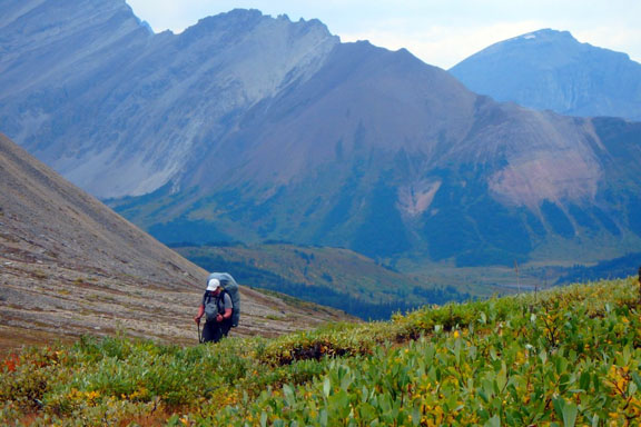
Jasper hikers have been using Rocky Pass on the park’s eastern boundary as the preferred access to the best scenery on Jasper’s South Boundary Trail for decades. However, if you are thinking of hiking through from there to Nigel Pass in Banff National Park, arranging vehicles at both ends is a logistical nightmare. To reach the Rocky Pass trailhead just south of Cardinal River Divide, it is a 143-km journey from Jasper townsite via Hinton, Cadomin and the gravel Grave Flats Road, which climbs through one of Alberta’s most active coal strip mining operations.
But most South Boundary Trail visitors aren’t through-hikers anymore. Cairn Pass is the real destination, which is 30 km from the Rocky Pass trailhead. For more details about trails and possibilities in this remote section of Jasper National Park, check out South Boundary Trail and Rocky Pass in the Canadian Rockies Trail Guide.
Note: The 10th edition of the Canadian Rockies Trail Guide describes the new official route of the South Boundary Trail – 120 km from Cardinal River Road to Nigel Pass trailhead on the Icefields Parkway.
0 Comments