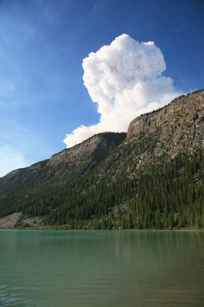
Spreading Creek Wildfire, as seen from across Lower Waterfall Lake.
The Spreading Creek Wildfire, ignited by lightning on Alberta forest land east of Saskatchewan River Crossing on July 3, 2014, has expanded into Banff National Park and resulted in the closure of several popular hiking trails.
Parks Canada has closed trails around Saskatchewan River Crossing, including Glacier Lake, Warden Lake, Mistaya Canyon, Sarbach Lookout and Howse River. Remote trails in the Siffleur River watershed leading north from Pipestone Pass and Dolomite Pass are also closed.
Fed by extremely dry conditions and above normal temperatures, the wildfire grew to 6,300 hectares by Saturday (July 12), including 1,000 hectares in Banff Park. Fire crews and aircraft from Alberta Environment and Parks Canada are currently working to contain the fire. Alberta Environment has closed the Kootenai Plains Ecological Reserve and all other trails and recreation sites in that section of the North Saskatchewan Valley.
The fire, which is burning just a few kilometres east of The Crossing Resort, has also required sporadic closures of the Icefields Parkway (Hwy 93N) and the David Thompson Highway (Hwy 11).
For a firsthand view of the Spreading Creek wildfire, check out this video from Alberta Environment: Spreading Creek Wildfire July 2014
0 Comments