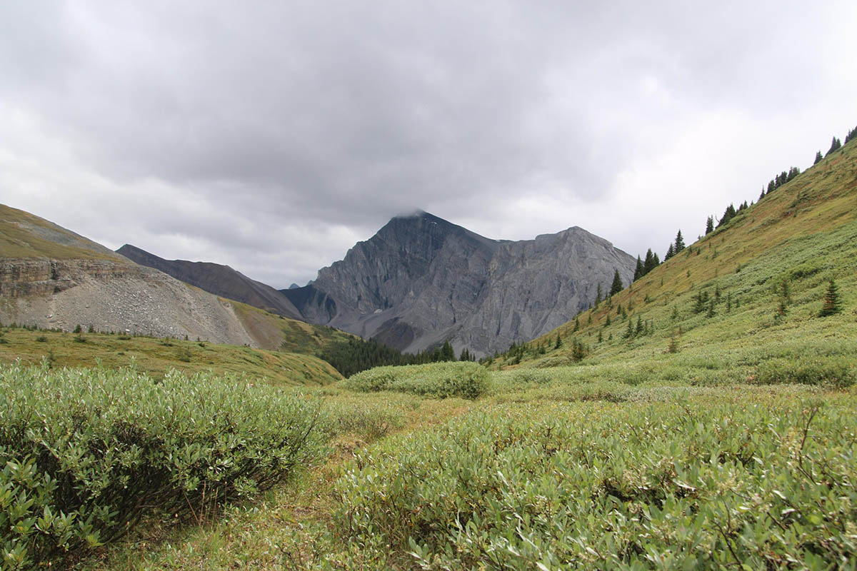
Domer Pass, Banff National Park
More and more backpackers are exploring Banff National Park’s Front Ranges every year, including the Dormer Pass-Panther River circuit. Mostly they enter the region on the Red Deer River, either from the headwaters at Red Deer Lakes or from the park’s eastern boundary at Ya Ha Tinda Ranch.
But there’s little doubt the most remote and seldom-travelled circuit leads over Dormer Pass and down the Dormer River, over Dormer-Panther Divide to the Panther River, and upstream on the Panther to the Windy Patrol Cabin.
Calgary backpacker Gavin Fitch set off in August with daughter Ellie and nephew Lief to explore the classic loop from the Cascade Fire Trail. Once they escaped the latter, they spent four days in Banff’s wildest southeast Front Ranges, where they encountered nary a soul.
Gavin used the Canadian Rockies Trail Guide (pages 169-172 of the 10th edition) as an inspiration for the trip, but his report should also serve anyone following in his footsteps:
Banff National Park Front Ranges South—August 21-27, 2021
by Gavin Fitch
Introduction
It was a tale of two trips. Days 1, 6 and 7 were fire road walking: hard on the feet and scenically challenged. Days 2-5 were true wild Front Ranges days: no people, lots of fords, wading through willows and tall grasses trying not to lose the trail, and sublime views.
Day 1
We got a 11:30 am start from the Cascade valley trailhead at the Upper Bankhead Parking Lot on the Lake Minnewanka Road. Within 40 minutes we crested a low divide and began the descent to the Cascade River. At an hour, we passed a bison drift fence and in another 15 minutes we reached the Cascade River Bridge and campsite. A big beefy bridge, designed (I guess) for bikers and winter skiers. After a short break we carried on. By 3:20 pm we reached the junction with the trail coming from Elk Summit and then the new bridge over Stony Creek. The old one was destroyed by the 2013 flood (I believe) and the remains of its concrete buttresses are scattered on the gravel outwash.
The campsite at Stony Creek has been refurbished. There are new tent pads, built with soft wood chips and bigger than the pads at older campsites. At the food area, there are now bear bins instead of poles and a new, large picnic table and a fireplace with benches. Very nice. We shared the campsite with one other hiker, who had walked from Ya Ha Tinda to Lake Louise, re-supplied, and was one day away from finishing a return trip from Louise to Banff. Impressive.
The Stony Creek campground is not the most picturesque we’ve stayed at, but there are nice views south of the north end of Cascade Mountain and east up the Stony Creek valley, our route tomorrow.
Day 2
The Cascade Fire Trail is washed out at Stony Creek, but re-emerges at the north end of the campground. There is another bison drift fence there, which runs for a distance along the north bank of Stony Creek. On the other side of the fence is the junction with the trail to Dormer Pass. The junction is un-signed but the Dormer Pass trail is easy to see.
We got a 9:45 am start under mostly cloudy skies. The trail begins by climbing over a southern spur of the Palliser Range, after which it descends to the creek for the first of many fords. According to the Trail Guide, there are 4 fords of Stony Creek between km 1.3 and km 9.2. Because of the trail being washed out by flooding, we forded Stony 8 times. In each case, it was relatively easy to pick up the trail on the opposite shore, because of flagging or cairns or both. The fords are ankle to lower-calf in depth. Whether you do this four times or eight times really makes no difference: your boots and feet are completely soaked. So personally I didn’t find the extra fords a big deal.
At the first ford we met a couple of young guys who were scrambling up Stony Mountain. They were the last people we would see until returning to Stony Creek campsite our final night. After rounding the southern spur of the Palliser Range, the trail trends north, following Stony Creek as it flows south on the east side of the range. After 6 km or so we stopped for our first proper break, after one of our fords. Beyond this, the creek and trail gradually turns northeast through a narrow gap in the main body of the Palliser Range. Before long we reached the “junction” with the trail to Stony Pass. The junction is signed, which is a good thing, since the trail to Stony Pass (which goes right) was not visible, at least to me. The trail to Dormer Pass strikes left, with one more ford of Stony Creek (to the north/west bank). We stopped for lunch on the other side of the creek. As we were approaching the ford, I saw in my peripheral vision a large shadow moving overhead. Looking up, I saw a magnificent bald eagle flying low over Stony Creek, following it down into the main valley.
After lunch, and the last ford of Stony Creek, the climb to Dormer Pass began. Although we’d been spit on by rain a few times, it started to rain properly for the first time. But we were mostly in the trees and fortunately it stopped raining as we broke out of the trees into the alpine. The entrance to Dormer Pass is marked by a beautiful ring of antlers laid out by the side of the trail. God knows how old it is. The Pass is stunning. We stopped to rest and take in the view, but unfortunately another wave of rain swept into the pass so we couldn’t linger long.
Thus began a long (3-4 kms) stretch through the alpine, way above treeline. The trail does a long S-curve from the south entrance to the pass. As we rounded the first curve, we saw a flock of mountain sheep grazing on the slopes above us. The next curve of the trail traverses high above a V-shaped valley that eventually runs into the Dormer valley. The mountain on the other side of the valley was striking: bare black slopes (coal, I presume) splotched with patches of vivid green vegetation. The trail continued to stay high, now crossing a large shale slope, before rounding the mountain and ending in a steep set of switchbacks leading down into the valley. What a magnificent stretch of trail.
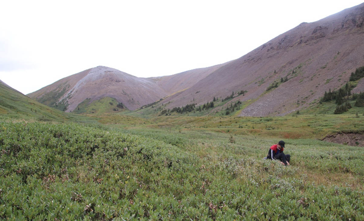
South entrance to Dormer Pass—the mountain sheep were grazing high up on the left side of the peak in the left half of the photo
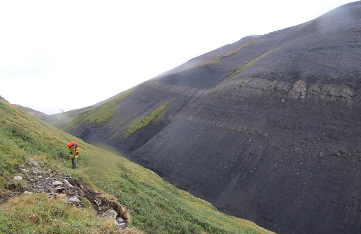
Northeast exit from Dormer Pass, black and green
Now the hard part began. At the bottom of the switchbacks the trail got pretty ugly, overgrown with waist to shoulder high willows. We had to be very careful not to lose the trail. As often happens later in a long day, it just seemed to go on and on, past when we thought we should be reaching our campsite. One problem was that we had only a vague idea of where we would camp. According to the Trail Guide, at 18.5 km the trail fords the Dormer just above the Dormer Warden Cabin . On the experience-proven theory that warden cabins typically occupy beautiful spots, the plan was to camp close to the cabin.
But the trail kept going, with no warden cabin in sight, and the weather continued to deteriorate. After what my GPS unit said was 21+ kms, the trail came to a ford of a tributary of the Dormer River, close to the valley bottom where it must flow into the river. Just off the trail was a small clear area in the trees, the forest floor soft and mossy. That was it. It was 6:30 pm and we threw down our packs. Within seconds it started to pour. We scrambled to get our tents up before they got completely soaked. It wasn’t pretty, but we got them up and threw our stuff in (most of it—there were some key misses). We stripped out of our wet walking clothes, got in our dry sleeping clothes, crawled into our bags and called it a day. No dinner. Notwithstanding the sad, wet end, it was an epic and memorable day.
Day 3
During the night it had stopped raining, thank God. But it will still mainly overcast. I took a reading with my GPS unit and compared it to the topo map. Turned out we were actually quite close to where I thought we would get to; it just didn’t look at all like what I’d imagined it would during trip planning! Having skipped dinner the night before, we had dinner for breakfast and broke our sad but functional camp. We crossed the creek and shortly after that the Dormer River. Soon we came to a sign at the eastern junction of the Dormer Pass and Stony Pass trails. Like the junction on the other side of the pass, but for the sign it would not have been at all apparent we were at a junction. I can only guess that the Stony Pass trail is challenging.
Now the trail followed the Dormer River downstream. Not far beyond the junction, the trail climbed the river bank and, through an opening in the trees, we saw the Dormer Warden Cabin, some distance away on the other side of the river. I had got it in my head from reading the TG that it was on the same side of the river as the trail. But it’s not. So the plan to camp next to the warden cabin was fatally flawed in any event.
According to the TG it would be about 6 kms to the junction with the Dormer-Panther Divide trail. The trip down the east bank of the Dormer was fine. No issues with the trail and as it wound in and out of the forest at the edge of the river flats there were some nice views. After a while the river bends eastward as it heads out of the park. During this stretch, the trail just disappeared at the top of the river bank—yet another washout. We scrambled down the bank, forded the river and stopped for a break. Searching for the trail I noticed a trail sign up on the opposite bank. It was the junction of the Dormer River trail with the Dormer-Panther Divide trail. So far so good.
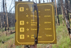
Trail sign between Dormer Pass and Panther River
The trail over the divide started by ascending through an old burn. The grey burnt trees “popped” nicely against the green forest floor. Unfortunately the weather turned on us again. It started raining steadily and, unlike yesterday, it was also cold. As we neared the divide the rain was flecked with snow. Any enjoyment we might have got from walking through this low but pleasant pass was nullified by the weather. We stopped for a belated lunch break on the way down and I put on my toque and gloves. On we slogged. We could see the Panther valley opening up before us and soon we came to the junction with the Panther River trail, which was signed. Our plan had been to walk approximately 4.5 kms up the valley into a big meadow with an old campsite, but we were so wet and cold we decided to stop at the first promising looking spot.
The TG suggests there is a hiker’s trail that stays on the south side of the river, while the horse trail (ie, the main trail) crosses and recrosses the river. If there is a separate trail on the south side we could not find it. If it had been warm and dry we might have spent some time trying to find it, but it wasn’t and we didn’t. Instead we followed the main trail, which took us directly to a ford of the river. On the other side we almost immediately found a nice clear area by the side of the trail with a fire ring someone had built. It was around 5 pm and that was it. Other than the odd spit it wasn’t raining so we boiled some water to have some tea and hot chocolate to warm up. Then we got the tents up. Within a few minutes of that it started raining again and, like the night before, we retreated into our sleeping bags to warm up. It rained steadily until just before 9 pm. Each of us considered whether it was worth it at that point getting up and having dinner. It was getting dark and we each came to the same conclusion: nope. So for the second night in a row we stayed in our tents and skipped dinner.
Day 4
We awoke to … glorious blue sky! Thank God. We had another dinner for breakfast and waited for the sun to climb over Dormer Mountain. As soon as it hit our stretch of the valley we started moving all the gear, including our tents—our entire camp—out of the shady trees and onto the sunny river flats, to dry. It was glorious. We took some time to both warm our bones and give our stuff some time to dry. A huge morale boost.
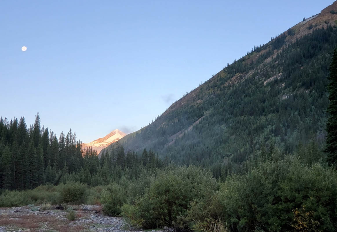
View up the Panther valley before the sun reached us and the moon was still in the sky
The hike up the lower Panther valley was sunny and wonderfully uneventful, apart from the 7 fords between our campsite and Windy Warden Cabin. As stated in the TG, about halfway along there is large meadow with gorgeous views in every direction. We passed the campsite noted in the TG. Nice, but nothing special.
After one of our fords we stopped for lunch and I confessed to the kids I was not feeling 100% and wasn’t sure about doing North Fork Pass the next day. Instead, I proposed that we camp for the night at our site from last year, by the corrals at Windy (we had planned to carry on past Windy and random camp farther up the valley, closer to N Fork), and go south over Wigmore Summit instead. There being no strong disagreement, we carried on.
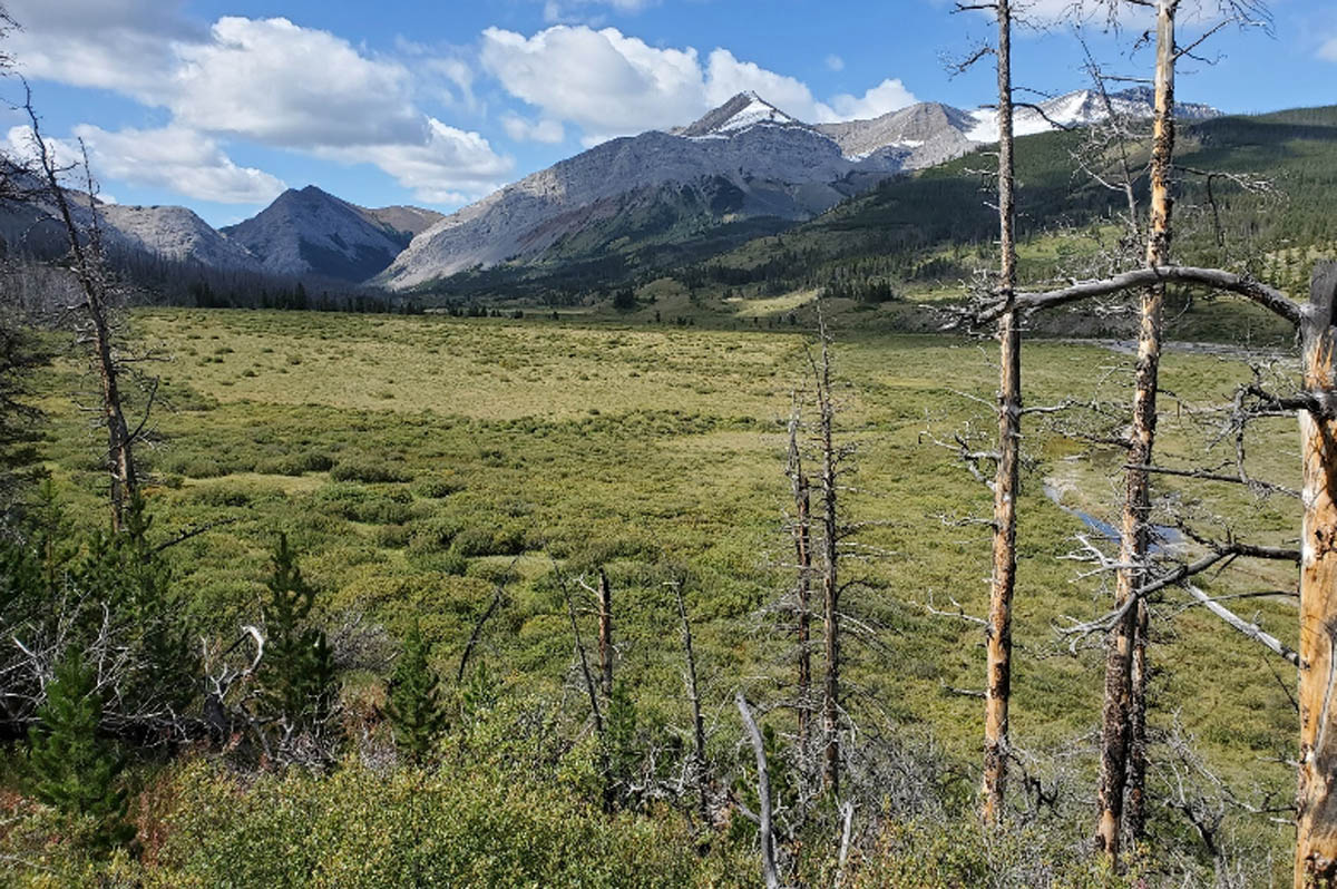
The large meadow between Dormer-Panther junction and Windy Warden Cabin
Soon after a ford to the north side of the river we came to the junction with the Elkhorn Summit trail, which was signed. I have to say I was pleasantly surprised that almost all the junctions we’d passed were signed.
Soon we entered the meadows where the Cascade Fire Trail intersects the Panther valley, so we knew we were getting close to Windy. For some time we’d seen lots of fresh bison dung on the trail and when we reached our campsite by the corrals, it was full of bison prints. But alas the bison were at least a day ahead of us and we saw none.
We arrived at around 4 pm and had lots of time to set up camp and enjoy the good weather—much as we had done last year. It felt great to be back at Windy, which has become one of my favourite places in all of Banff. Ellie christened it the “secret heart of Banff”. Had a lovely evening.
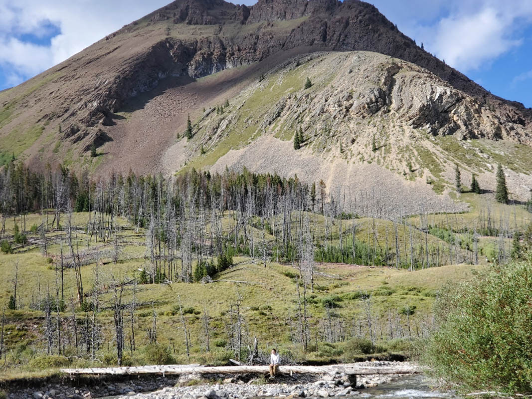
Ellie on the bridge over the Panther River at Windy Warden Cabin
Day 5
Another beautiful sunny day. We were on a roll! We decided to follow Plan B and struck out towards Wigmore Summit. We had day-hiked from Windy to the north end of the Summit last year. It’s an easy climb up the Wigmore Creek valley and the trail breaks out of the forest after only a couple of kilometres. As you go south the trail follows a high line on the east side of the valley, meaning the views are to the west. And the farther south you go, the better the views, until we stopped where we had lunch last year: just north of Wigmore Lake, where a long green side valley runs west toward three lovely peaks in the Vermilion Range. A fantastic view.
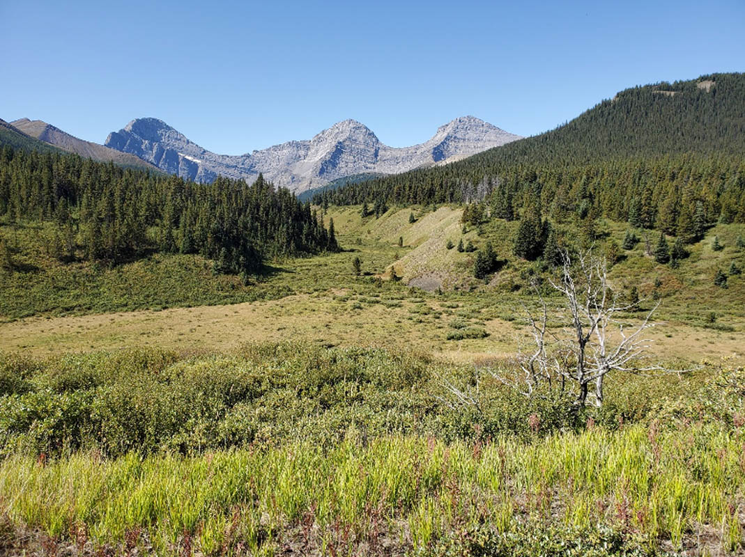
Looking west from the north end of Wigmore Summit on the CFT
We had just stopped and dropped our packs when Ellie saw an animal run from south to north (left to right) across the side valley. It disappeared for a moment and when it re-emerged we realized it was a wolf. It ran up the grassy slope on the north side of the draw. Then we heard it: from behind us, on the other side of the CFT, another wolf began baying. We were mesmerized. It bayed several times and at some point we realized it had moved closer to us. It must have been less than 50 metres up the slope to the east of us, hidden in the bushes. We figured it was agitated because we had come between it and its mate, so we put our packs on and slowly moved on. The baying stopped. What an experience.
We carried on and in a few minutes we reached the north end of Wigmore Lake, as far as we got last year. We resumed our break. Last year, we’d noted that the lake had flooded the trail as a result of beaver dams downstream and figured you’d have to bushwhack around the east side of the lake. Now, looking at it more closely, we realized that the trail was inundated in only a few short stretches, and not very deeply. So we carried on and had no problem getting past the lake. To our pleasant surprise, we had another several kilometres of hiking through open meadows with different views south opening up the farther we went.
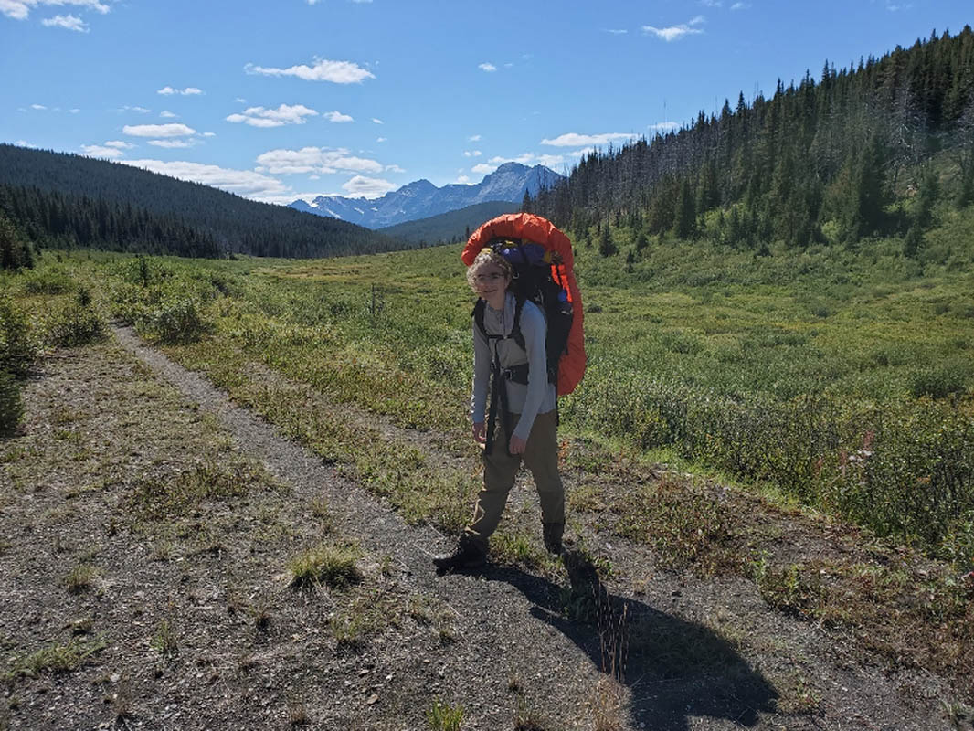
Ellie on the Cascade Fire Trail south of Wigmore Lake, looking south
We were still buzzed by the experience with the wolves, and I was feeling good, so I began thinking about whether we could make it to Flint’s Park, notwithstanding foregoing N Fork Pass. I recalled that the Trail Guide mentions, in the Flint’s Park trail description, a shortcut trail from the CFT intersecting the Flint’s Park trail. I told Ellie to keep her eye open for a junction and sure enough, farther down the trail after we’d picked up Cuthead Creek, we found a junction marked by a cairn. I took a reading on my GPS, compared it to the topo map, and figured this had to be it. I poked down the trail 20-30 metres beyond the junction. While at first very indistinct among overgrown grasses, I could see that the trail soon entered the forest and was clearly visible. This was a real trail. So we went for it.
It was in surprisingly decent shape. There was some deadfall, and open stretches where it was overgrown with willows, but for the most part it was distinct and easy to follow. It briefly climbed southwest away from Cuthead Creek and then contoured around a shoulder of the Vermilion Range. While we were close to the highest point on the shortcut, we entered an old burn and got an amazing view west/southwest down the upper Cascade valley, towards Flint’s Park and beyond:
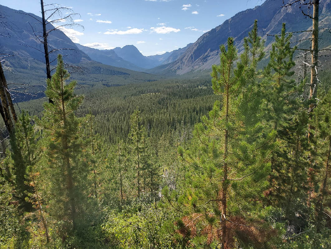
View looking west down the upper Cascade valley, from the shortcut trail from the CFT
After less than an hour and a half, bingo, we were on the Flint’s Park trail, with only 3.5 km to go to the campsite. Score! We arrived at Flint’s in the late afternoon and enjoyed the warm sunshine and having such a beautiful campsite all to ourselves. Plan B had turned out to be a phenomenal day.
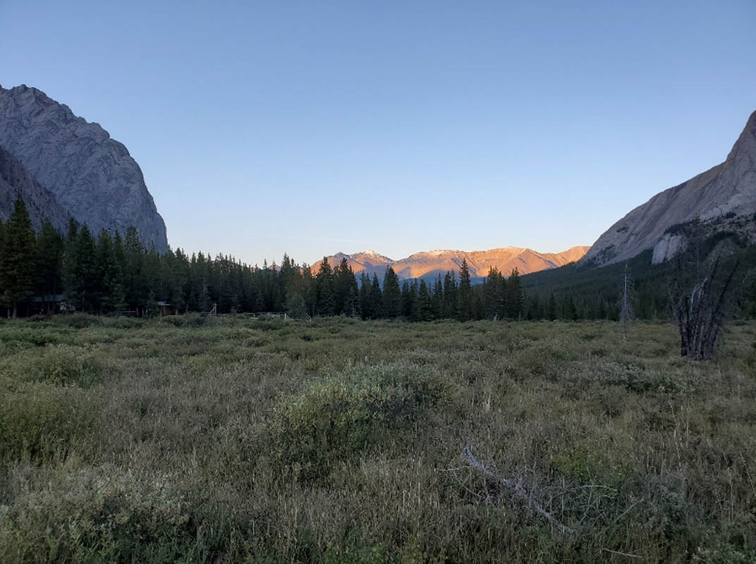
Sunset at Flint’s Park, looking east
Day 6
Knowing that we were now facing two days of fire road walking, we stayed at Flint’s all morning, enjoying the sunshine and peace and quiet. In the morning, before the kids were up, I was enjoying a coffee, got up to stretch my legs, and startled 3 deer who were grazing by the North Fork of the Cascade River, next to the campsite. We left just after noon and were back at Stony Creek by 4:30 pm. The only thing to report is we saw a very large skeleton right in the middle of the CFT a few kilometres away from Stony Creek. Given its size, it must have been an elk. The skeleton was picked clean and there were two of the legs, detached from the rest of the skeleton, with the hooves still attached. Spooky.
At Stony Creek, we met a biker who had come in with his son and his son’s friend. He was waiting for them while they did a 30 km scramble up Haunted Peak, which is accessed via the Dormer Pass trail. He hung in there till 7:30 and then left, clearly worried about them. They showed up half an hour later, gobbled down some food, packed their gear and hopped on their bikes to pedal back to Lake Minnewanka just as it was beginning to get dark. Hard core.
Day 7
We broke camp early and finished in time to lunch at Eddy Burger.
Conclusion
In some ways, I take hope from this trip. The little used trails up Dormer Pass, down the Dormer River, over to the Panther River, and upriver to Windy Warden Cabin, are still there and still hikeable. It really wouldn’t take that much work to upgrade them to a minimally acceptable standard, in my view. If Parks built backcountry campsites this would be a viable and fantastic long distance backpack loop trip for those who don’t mind getting their feet wet:
– on Stoney Creek, before the junction with Stony Pass
– on the Dormer River, before the ford to the junction with the Dormer-Panther Divide trail
– on the lower Panther River, somewhere in the big meadow downstream of Windy Warden Cabin
– on upper Cuthead Creek below Wigmore Summit,
Click here for a PDF trip report: Dormer Pass-Panther River Circuit
Dormer Pass-Panther River Trail log
Day | Distance (as per Trail Guide) | Comments |
Leg 1 – Upper Bankhead Picnic Area to Stony Creek campsite (Cr 15) | 15 km | New bridge over Stony Creek replacing the old one destroyed in the flood. Campground also rebuilt. |
Leg 2 – Stony Creek to Dormer River Camp near 1st crossing of Dormer River and Dormer Warden Cabin | 18 km
| Except for wash outs, trail up to Dormer Pass easy to follow and in decent shape. Trail down from pass to the Dormer valley very overgrown in places. |
Leg 3 – Dormer to Lower Panther River
| 14 km | Trail along Dormer River in decent shape and easy to follow. Washed out at ford. Dormer-Panther Divide trail also generally easy to follow, but definitely a horse trail with lots of large divots to navigate. |
Leg 4 – Lower Panther to Upper Panther | 12.5 km | Couldn’t find hikers’ trail on south side of river. Main horse trail has 8 fords between the junction with the Dormer-Panther divide trail and Windy Warden Cabin. Trail overgrown in many places. Generally better west of the Elkhorn Summit junction, presumably because of use by Parks staff monitoring the bison. |
Leg 5 – Windy Warden Cabin to Flint’s Park via Wigmore Summit and shortcut trail from CFT to Flint’s | 19 km (approx.) | CFT easy to follow. No problem navigating along the western edge of Wigmore Lake. Junction with short-cut trail is marked with a cairn—easy to find if you’re looking for it. Shortcut trail in surprisingly decent shape. Some deadfall but we’ve seen worse. Sections overgrown with tall willows. |
Leg 6 – Flint’s Park to Stoney Creek | 16 km | Wide double-track fire road walking. |
Leg 7 – Stoney Creek to Cascade trailhead | 15 km | Ditto |
| 110 km |
|
All photos by Gavin Fitch

Fantastic trip report!
This area is a hidden treasure in the park, rivalling some of the most scenic backcountry destinations I’ve visited.
The views are well earned. The travel is difficult, not for the faint of heart. The best!
I’m so happy to find this trip report! This is so useful. I’m planning a somewhat similar itinerary soon, at least in regards to Dormer/Panther. I was wondering if there was a reason you took the Wigmore Creek trail instead of the North Forks Pass trail to Flint’s Park? They seem like similar distances to me on my map. Thanks!
Hi Kelsey. We were going to go over North Fork only I was feeling a bit under the weather the day before and figured it would be easier to go over Wigmore Summit. Go over N Fork. I’d love to hear about it. A few years ago we day-hiked to N Fork from the south (Flint’s Park) the view from the Pass north towards the Panther valley is awesome. But the last grunt up to the pass from the north will be steep!
PS. Finding the trail to N Fork from the Cascade Fire trail is not easy. The junction is not marked and hidden by willows. But it’s just south of where the CFT crosses the Panther.
Thanks Gavin!
I wasn’t able to go up Dormer because of the prescribed burning in the area, so I went up towards Divide Pass and back down towards Flint’s park and eventually out by Lake Louise. I did though go over North Fork to get to Flint’s, and though I was definitely forewarned it was overgrown, that was one heck of a bushwhack! At one point there is about a kilometre long meadow that is just a solid clump of chest high willows, and in any forested section before the very end, the trail has been mostly grown over with moss and/or is covered with deadfall. After the first 5 or so kilometres where the trail was in good shape, I moved at a pace of about 1 km per hour until the top of the pass. I think the steep final bit may have been my favourite, because you could actually see and walk on the trail!
Someone has made an approximate route on Alltrails accessible, and while it’s definitely not accurate on the exact location of the trail, it was very useful in making sure I had a rough idea of where the route was heading, because without it I don’t think I would have figured out when or where I was supposed to make a turn, given the usual lack of footprints to follow and the large amount of animal trails that could be misleading.
It was though much more scenic than Wigmore, which I had come northbound on. Lot’s of pretty mountain valleys, and the top of the pass is terrific. It’s too bad that it’s in such poor condition, because if the trail was more clear it would be the much more exciting route.
Thank you for sharing such a detailed post! Your trip sounded challenging at times but so worth it!
How did you or the kids find the fords (particularly the Dormer River)? Were they wide, deep, fast moving water? I am planning a similar/same trip for this summer but I am trying to assess the risk of ford crossings (some experience but nothing very wide).
Also, where you mention Cuthead, did you have to ford, or did the trail just run along it?
Amberle,
The fords were not bad. I don’t recall any that were more than knee deep. It was the number of them: 8 on Stony Creek, 2 on Dormer River, 8 on Panther River and 2 or 3 on Wigmore Creek. I believe there was 1, maybe 2, fords of Cuthead Creek but they were minor.
Thanks for the trip report! It’s good to know that Dormer to Panther is doable, as I think we’re going to make that part of our route this year. We may have crossed paths with you going the other way on the CFT (we were heading in while you were heading out): https://canadianrockiestrailguide.com/from-lake-minnewanka-to-lake-abraham-via-banffs-front-ranges/
We definitely saw the same carcass and a couple guys saw the wolves too. This year it looks like we’re going to chance crossing the Clearwater. Start at Stony Creek, through Dormer, over Elkhorn and then Divide, across/up the Clearwater, and then out through Siffleur. Here’s to hoping for low water and partly overcast days!
Marcel,
I recall reading your trip report mentioning the elk carcass. We saw wolves at Wigmore Summit the same trip. I hadn’t considered that maybe they were the hunters of the elk. Who knows.
Your trip this year sounds great. Two things though. Parks did a prescribed burn in the Dormer valley last fall and I believe the Closure Order is still in effect. It covers the Dormer and lower Panther valleys (below Windy) as well as the Elkhorn trail south of the Panther/Red Deer Divide. You should check with Parks about whether it will be re-opened this year.
Second point, we planned to do Elkhorn a couple of years ago. You have to ford the Red Deer River at the north end of the trail. We took one look at it (from the north bank, along the trail to Ya Ha Tinda) and determined it was not possible. Definitely more formidable than the Clearwater ford.
I urge you to reconsider your “build campsites” conclusion. A huge part of the reason that areas like this remain so wild-feeling and “untouched” is precisely because there isn’t much infrastructure.
Keeping areas less-developed is _the_ way to keep the wild(-ish).