Some of the most scenic day hikes in the first edition of the Canadian Rockies Trail Guide went missing in the second edition. Here is the story behind these trails and why they disappeared.
Some of the most spectacular views from any day hiking trails in Western Canada are on display in Glacier and Mount Revelstoke National Parks. These trails were certainly a highlight in the first edition of the Canadian Rockies Trail Guide.
Yet, folks who read the first edition of the trail guide must have been a bit surprised when the second edition appeared and these trails were suddenly gone.
The decision to remove Glacier and Mount Revelstoke National Parks was a difficult one. First off, the Canadian Rockies Trail Guide expanded considerably with the second edition, adding a lot more detailed trail descriptions, particularly in Banff and Jasper National Parks. Plus, Glacier and Mount Revelstoke were in the Columbia Mountain range, not the Canadian Rockies.
But as I look back today, it was a bittersweet decision. The hikes we measured and photographed there were amongst our favourites during that long-ago summer of fieldwork.
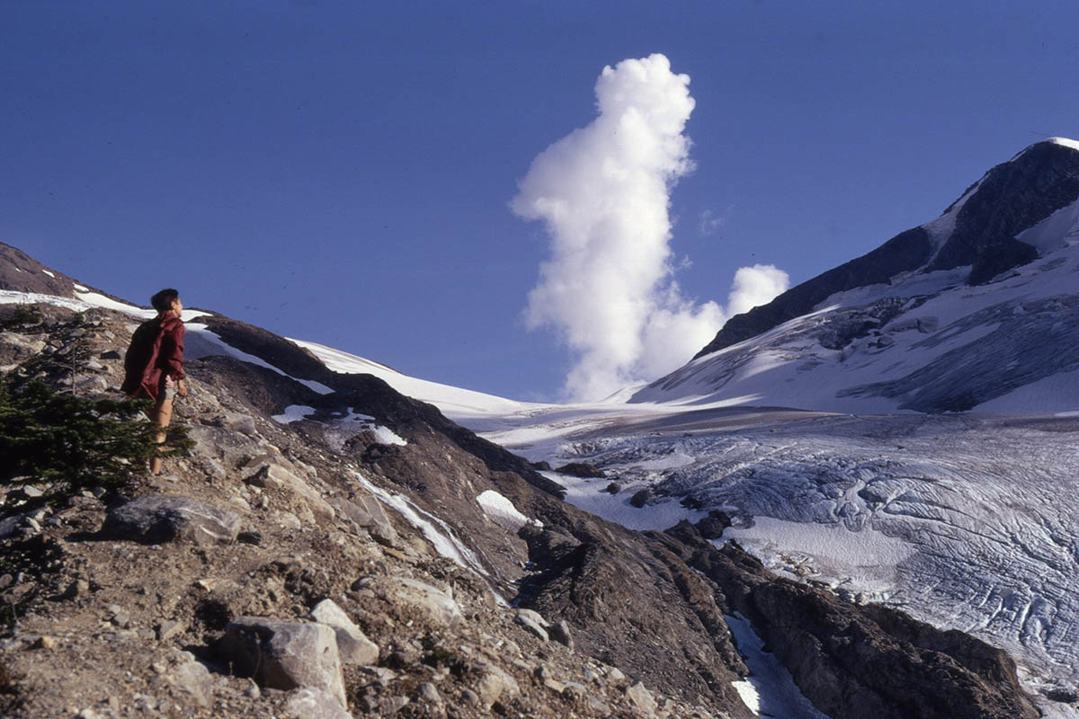
Asulkan Glacier
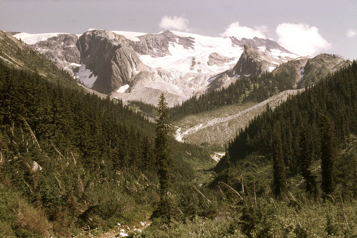
Memories of Glacier and Mount Revelstoke
We had already spent around eight weeks on the trails of Banff, Jasper, Yoho, Kootenay and Waterton Lakes when we headed for Rogers Pass during the first week of August. Skies had been mostly cloudy and grey in the Rockies. But when we got to Glacier, we were greeted by blue skies, white fluffy clouds, fields of wildflowers and more glacier ice than we’d seen anywhere in our two months in the backcountry.
Asulkan Valley near Rogers Pass, 1970.
Bart and I hiked, measured and photographed separate trails with our hiking partners from a base camp at Illecillewaet Campground—Hermit Hut, Asulkan Valley and Glacier, Perley Rock, Avalanche Crest, Abbott Crest (Ridge), and a backpack into Mount Revelstoke’s Jade Lakes.
Bart and I seldom hiked together that summer (trying to cover as many trails as possible). But on the last day of our fieldwork at Rogers Pass the weather and wildflowers were so glorious, he joined me and my hiking partner Louise for the trip to Balu Pass.
As we wrote in the first edition of the trail guide: “Balu (or Baloo) is an Indian word for bear, a name which is undoubtedly appropriate for the Balu Pass trail in Glacier National Park.” We continued with how the “hiker may be lucky enough to catch a glimpse of a handsome black bear hard at work in a berry patch.”
Little did we know that black bears are rare in Glacier National Park. The following summer, when the first edition of the trail guide was published, a hiker was badly mauled by a grizzly bear on the Balu Pass trail. Lucky indeed! (Today, there are grizzly bear warnings on virtually every trail in the park, and the Balu Pass trail has a 4-adult hiker group requirement from June 15 until September 30.)
Soon after the publication of the second edition of the Canadian Rockies Trail Guide, Parks Canada stepped up and released a free 41-page guide—Footloose in the Columbias: a hiker’s guide to the trails of Mount Revelstoke and Glacier National Parks. And in 1987, Chief Park Naturalist John Woods authored Glacier Country: Mount Revelstoke and Glacier National Parks—a general guide to the parks including trails.
Hiking the trails of Glacier and Mount Revelstoke today
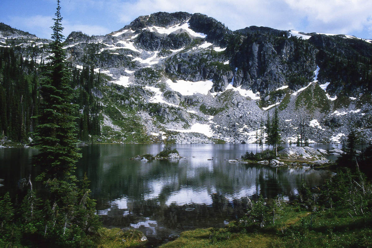
Millar Lake
Much has changed with the trails of both parks since those early days. There are far more hiking options than when we described the parks, particularly for shorter, interpretive walks. Today, hikers can download pdf trail guides containing trail descriptions and maps for both Glacier and Mount Revelstoke National Parks. Another excellent source of information is goldenhikes.ca, which provides more detailed descriptions for trails in both parks.
I’ve only hiked the trails of Glacier and Mount Revelstoke on a couple occasions since that August week during the trail guide summer. The trouble with both parks, we don’t think of them as destinations like those in the Rockies. We’re usually zooming somewhere on the Trans Canada Highway and don’t linger.
Aside from basing in the town of Revelstoke for Mount Revelstoke National Park, the only accommodation near Glacier’s prime trails is one of the park’s two highway-accessible, frontcountry campgrounds. Illecillewaet Campground (60 sites) and Loop Brook Campground (20 sites) are just west of Rogers Pass. Or the Alpine Club of Canada’s A.O. Wheeler Hut (capacity 30) provides highway-accessible accommodation a stone’s throw from the Illecillewaet Campground.
It’s not likely you will be able to wander into Illecillewaet Campground and find a campsite the way we did in the “old days” when we were completing fieldwork for the first edition of the trail guide. If campsites are full on your planned arrival, check out the private commercial campgrounds west of the park at Albert Canyon and Revelstoke. The cost of a tent site is around double what it is at Parks Canada sites, but still pretty reasonable compared to a motel room in Revelstoke or Golden.
All photos by Brian Patton
Your photos really make me want to check out this trail. Well-written article, appreciated.
Great post as usual, thanks for sharing – out of curiosity, did you ever explore any of the Bostock Creek, Flat Creek, Beaver Valley, Copperstain, or Glacier Circle trails? I feel like I constantly pester you with questions, hahaha, but I am really curious about these areas, too. Many of them exist on maps dating back to the 1920s in various forms (a trail running down the Beaver Valley all the way to Duncan Lake, for instance), or show up on old NTS maps (the trail over Bostock Pass extending down Casualty Creek to Mountain Creek on the old 82N05 map, including a warden cabin that Parks Canada doesn’t know anything about!).
Beta in this area, especially on longer trips, is extremely scarce – even more so than ‘obscure’ parts of the Rockies like the Ottertail/ Howse/ Athabasca Passes. That said, there seems to be an incredible amount of history here, tied to the CPR crossing Rogers Pass and the mountaineering boom that followed. It’s a shame that so much of this history, like in the ‘main’ mountain parks, is disappearing due to poor maintenance. Thanks so much as always.
With a couple exceptions, we haven’t been back to Glacier-Revelstoke since our fieldwork for the 1st edition of the trail guide. I wouldn’t get too excited about historic trails in that area since unmaintained trails get overgrown a lot faster than in the Rockies (Devil’s club?). If you download Glacier’s “Hiking and Camping” brochure, you can see which trails are maintained. I did find a few descriptions for less-travelled trails on AllTrails.com, like Bostock Creek to Bostock Pass.