Kootenay National Park is celebrating its centennial with a “Kootenay Then and Now: Recreate the Photo” contest. Since we began our fieldwork on the Mountain Parks’ first comprehensive trail guide 50 years ago, I thought it would be appropriate to reminisce by publishing a few photos from that long-ago summer of 1970.
That June we began hiking Kootenay’s trails, most for the first time. Measuring with a trail wheel and photographing for the first edition of the Canadian Rockies Trail Guide, which would be released a year later.
In addition to providing accurate measurements for the park’s trails, photographs allowed hikers and backpackers to view images of many backcountry destinations for the first time.
Those photographs were reproduced in the trail guide in black & white (and still are), but these early images are presented in colour here.
A bit of Kootenay hiking history
Planning for fieldwork on the Canadian Rockies Trail Guide began during the winter of 1969-70 with letters sent to all Park Superintendents. Kootenay’s Superintendent put us in touch with Kurt Seel and pioneer naturalist Ian Jack. We met with Kurt and Ian at Park Headquarters at Radium in early June. After receiving their advice and approval for our project, we set off to document the Juniper Trail and other lower elevation trails.
After that initial visit, we were off to do the same in other parks. As snow disappeared from higher trails in early July, we returned to measure the Rockwall and loftier day hikes. Less popular trails were measured and photographed over the next couple years and published in the CRTG‘s second edition.
One of the memories from those early days was hardly ever encountering anyone on the trails. And we had all the campgrounds on the Rockwall Trail to ourselves.
Following are a few photos from the summer of 1970. If you have any old photos from Kootenay Park trails (even older than ours), send them to oromaniacs@gmail.com and we’ll publish them in a future posting.
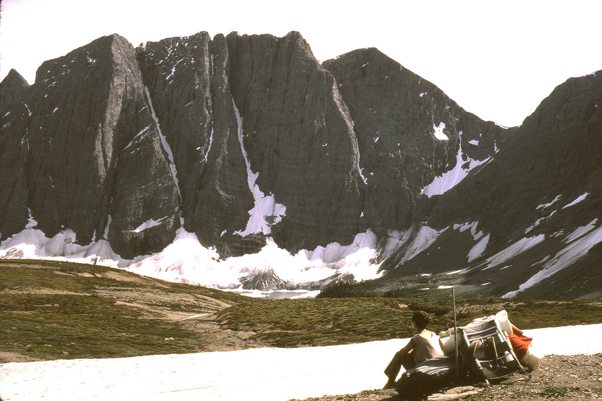
As snow melted out in the high country, we headed off to measure and photograph the Rockwall Trail. Floe Lake from Numa Pass on July 6, 1970.
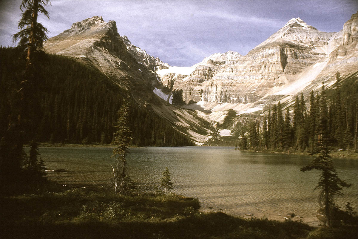
Kaufmann Lake at the head of Tokumm Creek was one of the few backpack destinations other than the Rockwall in the 1970s. But the wildfire that swept the valley in 2003 destroyed much of the trail. Today, there is no trail to the lake and the campground is gone.
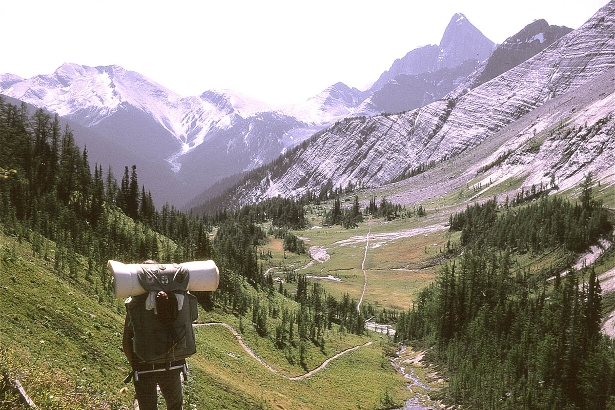
“The trail goes ever on”… The shot from Tumbling Pass on the Rockwall Trail taken on July 6, 1970, and used for the first cover of the Canadian Rockies Trail Guide.
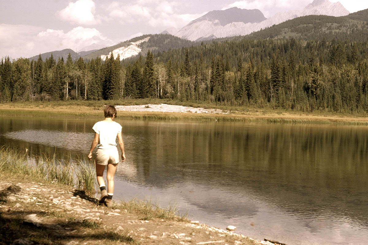
Dog Lake (top) and Stanley Glacier (below), both hiked and measured by Bart Robinson in 1970 and photographed by Brian Patton on August 29, 1971.
Thanks Brian. Very cool. I first hiked the Rockwall in 1989 but had no camera alas. Also did Kaufmann Lake in the 90s. I feel I may have some pics from that trip. Sad it’s one of the many trails that’s now no longer hikeable.
Hi Brian,
My husband, a friend and I went through Kootenay in Sept of 1974 starting at Lake O’Hara by McArther Lake and pass to the Ottertail cabin then up to Wolverine pass. Eventually to Floe Lake out to the Highway, up over Honeymoon pass and Egypt Lake finally reaching our destination of Sunshine. Walking out that last day so we could have a real meal in Banff. We never saw one person on the trail and only saw a car go by as we walked across the Kootenay Highway 93. It was magical! I believe we referred to your book for the info for our trip. Thanks for the continuing support of hikers like myself and my family over all these years!!!
I love looking at old pictures from the Rockies. The vintage look of film cameras gives the Rockies such a prettier look than the super high resolution of today’s camera. I was born in ’85 so of course all that I’ve hiked in these mountains so far was done in the last few years. But I love old places like Kaufmann Lake and I will give it a try this summer. I would love to possibly retake the same pictures from the 70s like the one on this page. It’s the first one I come across from pre-burn era. Any chance I could see more from the lake from your old pictures?
I have a couple admissions. We were notoriously frugal with our photography in those days, and I only have three photos of Kaufmann, all virtually the same. And another confession, I “antiqued” these photos to eliminate the cold, blue look of the scanned slides. I hope you can make it to Kaufmann and will report back on your trip.
Hi Laurent,
I’m curious if you managed to get to Kaufmann Lake and, if so, what the experience was like!
Did you ever hike the old trail over Ottertail Pass? I can’t find much record of it since the 1970’s but I did wander a few hundred meters up the old trail up Ochre Creek this year and it was still visible. Would be interesting to know what the old trail was like over the pass and if it’s still passable.
We skipped the Ottertail Pass trail when we did the original edition of the trail guide. It seems it was only used by park wardens on patrol, and since the pass was only around 2000 m, there was no alpine scenery. Kootenay park naturalist Larry Halverson rode through the pass with warden John Taylor in the 1980s and describes “a lot of bush” on the Yoho Park side of the pass. No trail is shown on historic 1:50,000 maps for a long stretch on the Yoho side. But if wardens rode it annually in the “old days”, there should still be traces of trail. If you ever do hike the pass, we’d be interested in a report.
Was also curious about this. Poked around this past summer but couldn’t even find the old trail when we were at Helmet/Ochre this past summer. I read an older report on Bivouac indicating someone tried to find the trail from the McArthur side, but got lost around Ottertail falls. The meadows themselves at the pass seem pretty nice, if the trail up from Helmet/Ochre is still viable it could be an interesting area to check out. Another obscure old Kootenay Park brochure indicates there was a tent site in the pass long ago, too.
This is a long time late, but I went to Ottertail Pass a couple septembers ago. There is a faint trail and slashes on trees to follow leaving the Ochre-Helmet junction campground (follow the right fork creek through the campsite). The trail was overgrown (lots of blueberries, saw bears both ways), but got better when it started to switchback (trail was well incised on the slope), and was trail runnable by ~1850 m. In the meadows there were reflective markers every 100 m. The pass was lovely, very open and wide, pretty good views. The ridge separating Ottertail and Goodsir passes was easily ascendable. I returned via Goodsir Pass, so I didn’t appraise the Yoho side of the pass, but it was pretty easy to follow in the pass…
We hiked Kaufmann lake as our first backcountry hike years ago with the heaviest gear ….the last km up to the lake was not easy. It was a stunning location and it felt remote. If it still existed as a hike I have no doubt it would be a popular destination today.
Dear Brian
I worked in the backcountry of Kootenay, Banff and Jasper in the 70’s and purchased your trail guide when it first came out. It finally fell apart from being packed around so many times!
I just read the blog and emailed you some photos of Kaufmann Lake from July 1972. Such a remote, beautiful place.
Kind regards