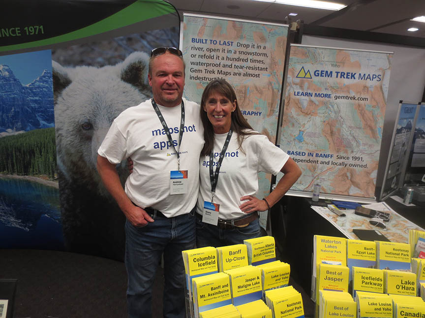
Andrew and Dianne Hempstead, publishers of Gem Trek maps, at the 2022 Mountain Film & Book Festival in Banff. Since 1992, Gem Trek maps have provided the best, most up-to-date coverage for backcountry trails in the mountain National and Provincial Parks. Rhonda Allen photo.
Maps in guidebooks are limited at best. Throughout the history of the Canadian Rockies Trail Guide, the book’s maps provided a very general impression of trail locations, points of interest, and destinations.
So, right from the first edition of our trail guide, we recommended detailed maps we thought useful for hikers. And we needed those same maps during our fieldwork and to provide accurate descriptions.
Though overview topographical maps of the national parks were produced starting as early as the 1920s, the scales varied and were usually not detailed enough to be useful for day hikers.
There were two excellent, detailed topographic maps (one inch equals one mile) produced by the Office of the Surveyor General in the mid-1920s—Banff and Area and Lake Louise. However, both maps were never updated and out of print during the 1930s.
The most detailed Canadian government maps were produced by the National Topographic System. These maps are scaled at 1:50,000 (0.8 mile to the inch and 100 foot contour intervals), so we opted to list them in our reference summary.
For our own fieldwork, that meant purchasing more than 60 of these maps to have full coverage for the mountain National and Provincial Parks. If the number of maps seems a bit excessive, it certainly is by today’s standard. In those days, there were very few full-sized sheets. In other words, two sheets were required to cover most areas of the Rockies. Using the Banff region as an example, that meant two 1:50,000 scale maps, Banff 82 O/4 East and Banff 82 O/4 West.
But if cost and coverage weren’t enough of a frustration, trail coverage was spotty at best. Even some of the most popular trails weren’t shown, like Bourgeau Lake and Parker Ridge in Banff, and Bald Hills Lookout and Cavell Meadows in Jasper. That required our labelling “trail not shown” for many of our map references.
A couple maps covering remote sections of the parks even had blank sections, meaning areas that weren’t yet surveyed in the 1:50,000 scale. (It brought to mind the story of 14th century maps that labelled unmapped and unexplored territories with the line “Here be dragons”.)
Though we recommended these NTS 1:50,000 maps to both day hikers and backpackers, I’m sure very few bothered to purchase them. (In those days, these maps were sold at Park Visitor Centres, the Banff Book and Art Den, and several outdoor retailers in Banff and Calgary.)
Mapping the trails
By the time the third edition of the trail guide published in the mid-1980s, half sheets had disappeared and all government NTS 1:50,000 maps were published as full sheets. However, popular trails were still not shown or misplaced on many of these maps, particularly in Jasper.
While our trail guide maps evolved to show elevated topography, coverage was still spotty and very basic. So, we continued recommending NTS maps as the best option for hikers.
Some independently-produced maps designed for specific, popular areas of the mountain parks did appear during this time, like Lake O’Hara and The Rockwall. But these maps weren’t widely available and there was nothing that covered broad sections of the region.
Until 1992. That is when Gem Trek maps came on the scene. Produced by Donna and Roger Nelson of Cochrane, Alberta, these maps were designed specifically for hikers. They were topographical, updated regularly, and produced with colour relief shading.
In 1996, I was contracted by Banff National Park to produce text summaries of the park’s trails with our measured distances for trailhead signage. And Gem Trek was contracted to produce the maps for these signs. Suddenly, accurate maps complete with hiking trails, routes, and campsites, were widely available throughout the region.
By 2000, when we published the seventh edition of our trail guide, Gem Trek maps had expanded to cover all but the most remote sections of the mountain parks. We decided to list the 1:50,000 scale versions as recommended sources to accompany our text descriptions, but we still listed NTS maps when Gem Trek 1:50,000 maps didn’t cover specific trails. (I’ve treated the history of Gem Trek maps in a previous blog Hiking with Gem Trek, August 15, 2014.)
That policy continued until the tenth edition of the trail guide was released in May, 2022. Despite some trails only being covered in 1:100,000 scale on some Gem Trek maps, we decided the information provided was far superior to that of NTS maps. So, in addition to incorporating full-page sections of Gem Trek maps in the new edition of the colour Canadian Rockies Trail Guide, we listed these smaller scale maps in our reference section as well.
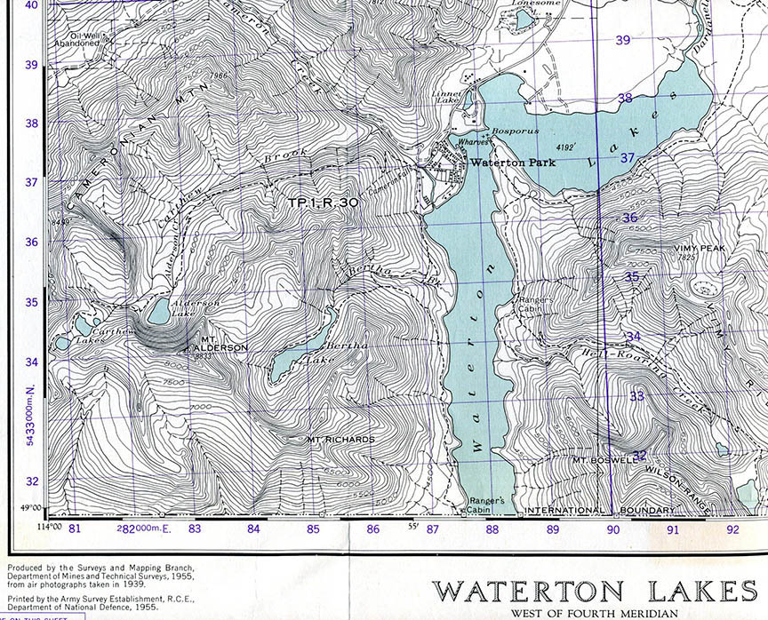
One of the maps we used and recommended in the first edition of the Canadian Rockies Trail Guide. The Waterton Lakes, 82 H/4 West sheet (partially shown here) covered the eastern section of the park. The map was published in 1955 using aerial data from 1939, which meant it was badly out of date. Meanwhile, the western section of the park was covered on a separate sheet, Sage Creek, 82 G/1 East.
National Geographic maps
While Gem Trek maps provide the detail required for nearly all mountain park day hikes, the series only provides partial coverage for remote backpacking trips.
In 2012, National Geographic maps entered the scene with a 4-map set covering the four mountain parks of Banff, Kootenay, Yoho and Jasper. Though produced in a 1:100,000 scale, these maps were similar to Gem Trek productions in that they were full colour, printed on waterproof and tear-resistant material, and revised regularly.
These maps were so reliable and used by so many long-distance backpackers, we decided to reference them in the latest edition of our trail guide as well.
Mapping in the 21st century
Maps have come a long way since we published the first edition of the Canadian Rockies Trail Guide in 1971. Smart phones and GPS units are used by many hikers these days (yours truly included). But there still is no replacement for a full-size, printed map when it comes to providing a comprehensive view of the mountain landscape and the latest information on backcountry facilities.
Check out links to Gem Trek and National Geographic for Canadian mountain park hiking maps.
Check out “Is map-reading a lost art?”, CBC News, June 11, 2023.